15 MINNETUXET WAY
Owner Information
RYAN THOMAS G JR
15 MINNETUXET WAY
YARMOUTH PORT, MA 02675


Property Details
15 MINNETUXET WAY is classified as a Single Family Residential (Colonial).
The primary structure on this property was built in 1998. There are 3,400ft2 of built area within this property. There is 1,972ft2 of residential/living space within this property.
15 MINNETUXET WAY is valued at $536,100. The land is valued at $182,300 and the structures are valued at $350,900. There is an additional valuation of $2,900 on this property.
The most recent deed for 15 MINNETUXET WAY is recorded at the local registrar in Book 11964, Page 314. 15 MINNETUXET WAY was last sold on Monday, January 4, 1999 for $225,000.
Assessment data from fiscal year 2022.
Flood Data
According to the FEMA National Flood Hazard Layer, this property does not appear to be in a flood zone. It may also be in an area not yet reviewed. Nonetheless, confirm this information prior to taking any action.
To view the flood hazards around this property, create a FEMA "Firmette" Map of the area around 15 MINNETUXET WAY.
Broadband Internet Providers
| Provider | Type | Bandwidth (mbps) | |
|---|---|---|---|
| HughesNet | Satellite | 25 | 3 |
| GCI Communication Corp. | Satellite | 0 | 0 |
| VSAT Systems, LLC. | Satellite | 2 | 1 |
| T-Mobile | Fixed Wireless | 25 | 3 |
| Verizon New England Inc. | DSL | 5 | 0 |
| Viasat Inc | Satellite | 35 | 3 |
| Comcast | Cable | 1000 | 35 |
Broadband service provider data from December 2020.
Adjacent Properties
- 500 ROUTE 6A
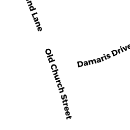
Single Family Residential owned by FITZGERALD SHEILA M TRS - 15 DAMARIS DR
Single Family Residential owned by BROWER JAMES N - 19 DAMARIS DR
Single Family Residential owned by KUSSMAUL ALBERT E - 27 MINNETUXET WAY
Single Family Residential owned by NASSON MARK A - 490 ROUTE 6A
General Office Buildings owned by BROIDRICK PC MARION TRS - 486 ROUTE 6A
Single Family Residential owned by RYAN MELISSA J - 496 ROUTE 6A
Single Family Residential owned by WARREN JAMES L - 21 MINNETUXET WAY
Single Family Residential owned by SHERMAN PATRICIA A TRS